Object Search Record
Images
Metadata
Catalog Number |
1976.1.7003 |
Object Name |
Map |
Date |
ca 1905 |
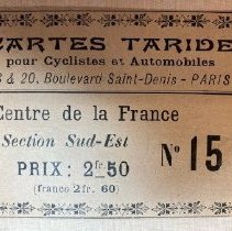
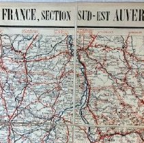
Title/Pattern |
Carte routière pour Cycilistes et Automobiles / Map # 15 / Centre de la France / Section Sud-Est |
Artist/Author/Creator |
A Taride, editor and publisher |
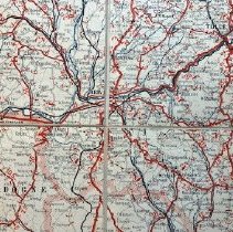
Description |
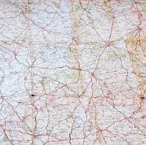
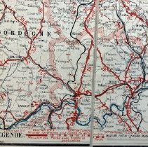
This large four-colored map is printed on heavy stock backed by a linen-like canvas with allowances for folding in several ways. It is designed to be used by cyclists and automobile drivers touring south-east France in the region of the Auvergne from the Dordogne to the Haute-Loire. The map is No 15 in a series by the editor and publisher A(lphonse) Taride. It is printed in French. The legend shows categories of extensive information: route degrees of incline and decline; distances between places; road surfacing and its quality (important especially to cyclists); major regional cities and small villages; and rivers and streams. Scale is 1/250,000. Blithewold also owns maps No.11 and No. 20 from the series. Object #s 1976.1.7001 and 1976.1.7002. |
Materials |
paper on linen-like canvas |
Condition |
Fair |
Search Terms |
Map Travel Europe France Cyclist Automobile |
Catalog Sub-category |
Documentary Artifact |