Object Search Record
Images
Metadata
Catalog Number |
1976.1.7002 |
Object Name |
Map |
Date |
ca 1905 |
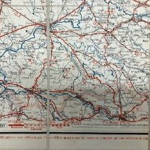
Title/Pattern |
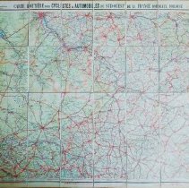
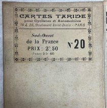
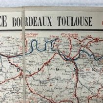
Carte routière pour Cycilistes et Automobiles / Map #20 / Centre de la France / Section Sud-Est |
Artist/Author/Creator |
A Taride, editor and publisher |
Description |
This large four-colored map is printed on heavy stock backed by a linen-like canvas with allowances for folding in several ways. It is designed to be used by cyclists and automobile drivers touring southwest France in the regions of Toulouse and Bordeaux. The map is No 20 in a series by the editor and publisher A(lphonse) Taride. The series covers the entirety of the county and is printed in French. The map legend shows categories of extensive information: route degrees of incline and decline; distances between places; road surfacing and its quality (important especially to cyclists); major regional cities and small villages; and rivers and streams. Scale is 1/250,000. Blithewold also owns maps No.11 from the series which covers south western France and map No.15 which covers the center of France. Object #s 1976.1.7001 and 1976.1.7003. |
Materials |
paper on linen-like canvas |
Condition |
Fair |
Search Terms |
Map Travel Europe France Cyclist Automobile |
Catalog Sub-category |
Documentary Artifact |