Object Search Record
Images
Additional Images [6]
Metadata
Catalog Number |
1976.1.7000ab |
Object Name |
Map |
Date |
1892 |
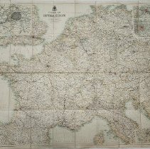
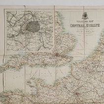
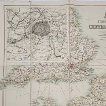
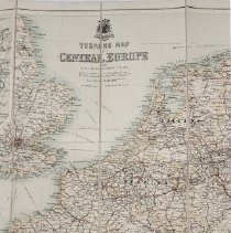
Title/Pattern |
Touring Map of Central Europe |
Artist/Author/Creator |
Bartholomew, J(ohn) G(eorge), 1860-1920 |
Description |
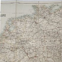
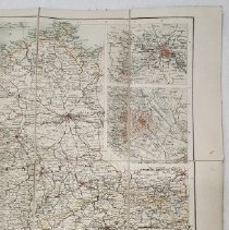
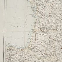
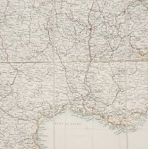
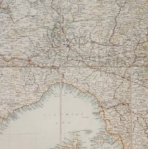
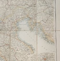
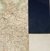
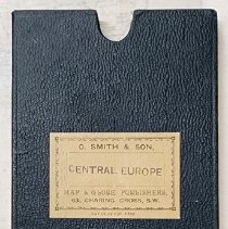
This large, folded touring map of Central Europe is one of many produced for different audiences and purposes, published by the multi-generational family of Bartholomews in Edinburgh, Scotland. Many of the maps in the family's World Series of Travelling Maps are for motorists or those travelling by train. The map includes at least parts of Great Britain, France, Spain, Holland and Belgium. A copy of it as well as the business records of the Bartholomew publishing company (under a variety of names) are kept in Special Collections in the Maps Reading Room, The Library of Scotland, Edinburgh. The Library will provide at cost a copy of the map upon application. This map (a) is folded into a 7 1/2"x 4 1/2" flat navy blue cardboard box which serves as a map case (b). On the front of the box is a pasted-on label indicating that it was produced by Map and Globe publishers of 63, Charing Cross, S.W. (London). On the right side of the box is a small label "CENTRAL EUROPE, after which is an indecipherable character. The map itself measures 29 1/2" tall and 35" wide when unfolded. It is printed in color on a light-weight canvas. At the top of the map there is a Bartholomew company logo and the map title, "Touring Map of Central Europe." |
Materials |
paper, cardboard |
Condition |
Fair |
Search Terms |
Map Map, Travel Travel Europe |
Catalog Sub-category |
Documentary Artifact |