Object Search Record
Images


Metadata
Catalog Number |
1976.1.7006 |
Object Name |
Map |
Date |
1909 |
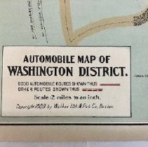
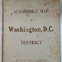
Title/Pattern |
AUTOMOBILE MAP / OF WASHINGTON, D.C. / DISTRICT |
Description |
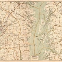
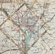
This colored map is published by Walker Lithographer and Publishing Company of Boston. It is sturdy when folded and, although cumbersome when fully opened, is not fragile. It covers all of DC as well as the surrounding environs of Falls Church on the west and Denton on the east; Ellicott City on the north to Church Creek on the south. Running north to south throughout the entirety of the map is the Chesapeake Bay.with its islands marked. In the DC district, the Potomac and Anacostia Rivers are delineated accompanied by a very small matrix of the streets of central DC. The map is designed for automobile travel. |
Materials |
Paper |
Condition |
Fair |
Search Terms |
Map Travel Automobile Washington, D.C. |
Catalog Sub-category |
Documentary Artifact |